News
Back to news
Apokoronas claims vast mountain pasture near Asi Gonia as municipal land
Announcement · Municipality of Apokoronas

Apokoronas claims vast mountain pasture near Asi Gonia as municipal land

Summary

On September 1, 2026, the municipality of Apokoronas officially declared that the Madara highland pasture above Asi Gonia — more than 6.5 million square metres of land — belongs to the municipality, not to private families. A handwritten note on the survey map that allocated shares of the land to local families was crossed out at the request of the village head. Community leaders and anyone with an interest in the area were given until Wednesday, September 2, 2026, at 2:00 p.m. to come forward with objections and supporting documents.

Apokoronas stakes claim to Asi Gonia's vast highland pasture

A long-running question over who owns one of Apokoronas's largest stretches of highland grazing land has taken a decisive turn. On September 1, 2026, the head of the Asi Gonia local community, Georgios Sbyrakis, appeared at the Apokoronas municipal offices alongside a witness and signed a declaration confirming that the Madara pasture — a sweeping plateau above the village — is municipal property.

What is the Madara of Asi Gonia?

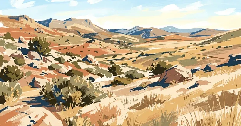
The Madara is an expansive highland plateau in the Apokoronas area of the Chania regional unit, Crete. It covers two adjoining plots of land:

  • Plot A: 5,976,199.70 square metres
  • Plot B: 540,494.27 square metres
  • Total area: approximately 6,516,694 square metres — more than 650 hectares of open highland

The area borders the communities of Asi Gonia, Alikampos, Kournas, and Askyfou, and has been the subject of boundary agreements between neighbouring villages since the 1940s and 1950s.

What happened on September 1, 2026?

A survey map drawn up in March 2023 contained a handwritten note stating that the Madara was divided among certain families from Asi Gonia, with each entitled family receiving a one-twenty-seventh share — a maximum of 241,359 square metres per family.

That note was crossed out on September 1, 2026, on the instruction of the community head. The reason given: both Plot A and Plot B belong in their entirety to the municipality of Apokoronas, making any claim of private family ownership invalid under the official survey.

Who could be affected?

This decision could have real consequences for several groups of people:

  • Families from Asi Gonia who believed they held hereditary rights over parts of the Madara
  • Farmers who work the land and may receive EU agricultural subsidies based on these plots
  • Residents and community leaders from the neighbouring villages of Alikampos, Kournas, Askyfou, and Patsianos, whose boundaries touch the Madara

Urgent deadline: Wednesday, September 2, 2026, at 2:00 p.m.

The municipality has called on all community leaders in the surrounding area, as well as any private individuals with an interest in the Madara, to come to the Apokoronas municipal offices before 2:00 p.m. on Wednesday, September 2, 2026, in order to:

  • Submit objections to the municipality's ownership claim
  • Provide documents supporting private or communal property rights
  • Protect any subsidies or usage rights that depend on recognised ownership of these plots

Missing this deadline risks having your claim overlooked in any future process.

Historical roots of the dispute

The earliest formal record of the Madara's boundaries dates to May 11, 1956, when the then-village council of Asi Gonia officially mapped the limits of the area. Those boundaries were also established through a series of bilateral agreements between Asi Gonia and its neighbouring communities during the 1940s and 1950s. The 2023 survey map — which forms the basis of today's declaration — was prepared by civil engineer Vasileios Kontezakis and relied on historical documents as well as on-site boundary marking carried out by community head Georgios Sbyrakis.

Download the official survey map

The full topographic survey of the Asi Gonia Madara is available to download from the municipality's website:

Official source

Source translation

Machine-translated from the official source document.

PRESS RELEASE – ANNOUNCEMENT – INFORMATION

September 1, 2026, 2:35 p.m.

Today, 01.09.2026, the President of the Local Community of Asi Gonia, Mr Georgios Sbyrakis, and another witness appeared at the Municipality of Apokoronas and declared that the property of the Municipality of Apokoronas in the area of the Madara in Asi Gonia is depicted in the topographic diagram of March 2023, in which the President of the Local Community of Asi Gonia states in handwriting that the specific Madara belongs to the extent of 1/27 to each family (soi) on the basis of a family tree.

In total, each entitled family may not receive more than 241,359 sq.m.

This note was crossed out today on the instruction that Plot A of 5,976,199.70 sq.m. as well as Plot B of 540,494.27 sq.m. belong to the property of the Municipality of Apokoronas, overturning the claim of private ownership, in accordance with the attached topographic diagram.

The Presidents of the Local Communities of Alikampos, Kournas, Askyfou, Patsianos, etc. and any interested parties in the specific area are requested to appear at the Municipality of Apokoronas by tomorrow, Wednesday 02.09.2026, at 14:00, in order to submit any objections and related documents so that the rights of citizens (ownership, subsidies, etc.) may be safeguarded.


CONTENT OF THE ATTACHED TOPOGRAPHIC DIAGRAM (PDF)

Title: AREA MEASUREMENT OF PLOT B (within the Cadastral District of Kournas)

Note: Using the ordered coordinates of the vertices

Scale: 1/15,000

Diagram title: SURVEY OF THE COMMUNITY MADARA OF ASI GONIA, APOKORONAS

Diagram preparation: Kontezakis Vasileios, son of Antonios, Diploma Civil Engineer, National Technical University of Athens (NTUA)

First historical boundary record: COMMUNITY COUNCIL OF ASI GONIA (11 MAY 1956) & BILATERAL DECISIONS OF THE NEIGHBOURING COMMUNITIES WITH THE COMMUNITY OF ASI GONIA FROM THE DECADES OF 1940 & 1950

President of the Community (1956): GYPARAKIS IOSIF, son of Andreas (Blattios)

Secretary (1956): SBYRAKIS STYLIANOS, son of Georgios (priest) (The authenticity of the document is certified by the fingerprint of the President of the Community)

Boundary indication 2023: SBYRAKIS GEORGIOS, son of IOANNIS (Community President of Asi Gonia 2019–2023)

Date of study preparation: MARCH 2023

Diagram scale: 1/15,000

Aerial photographic base: ORTHOPHOTOS OF THE HELLENIC CADASTRE / date of capture: 2015

Perimeter:

  • Plot A: 14,906.38 m
  • Plot B: 5,768.07 m
  • Total: 20,674.45 m

Area:

  • Plot A (Geotemachio-A): 5,976,199.70 sq.m.
  • Plot B (Geotemachio-B): 540,494.27 sq.m.
  • Total: 6,516,693.97 sq.m.

Coordinate point (example): 66 — E: 524,396.36 / N: 3,806,982.55 / H: 159.41

Area calculation formula: E = 1/2 Σ(Xi + Xi+1)(Yi − Yi+1) E = 540,494.27 m²


DIAGRAM LEGEND

  • Area of Plot A with vertices (1-2-3-4-5-6-7-8-9-10-11-12-13-14-15-...-129-130-131-132-133-134-135-1) = 5,976,199.70 sq.m.
  • Area of Plot B with vertices (66-67-68-69-70-71-...-93-94-136-137-138-139-140-...-169-170-171-172-66) = 540,494.27 sq.m.
  1. Dimensions and areas were calculated analytically from the coordinates of the vertices.
  2. The diagram is registered in the state coordinate system E.G.S.A. '87.
  3. The referencing to EGSA '87 was carried out using a dual-frequency GPS receiver (LEICA GS14), using the Hellenic Positioning System HEPOS via the HxGN SmartNet NRTK network of METRICA A.E.
  4. The boundaries were indicated on site and on his own responsibility by SBYRAKIS GEORGIOS, son of IOANNIS, Community President of the Local Community of Asi Gonia.

The engineer: KONTEZAKIS ANT. VASILEIOS DIPL. CIVIL ENGINEER NATIONAL TECHNICAL UNIVERSITY OF ATHENS (NTUA) TEE Registry No.: 111452 / A.B.M.: 112357253 Konstantinou Kanari 22, Koumbes Chania, P.C. 73300 Tel.: 6983111000 / 2821020258 Email: [email protected]


SOLEMN DECLARATION OF THE UNDIVIDED CO-OWNER

The undersigned ..... son/daughter of ..... and ..... resident of ....., TAX ID (AFM): ....., telephone: ..... and email: ....., hereby declare responsibly that I hold rights as an undivided co-owner of PLOTS A (Madara of ASI GONIA) and PLOT B (Madara of Kournas) as depicted in the present Diagram, in an area equal to ..... of the total area, corresponding to a share of .....% as undivided co-owner (i.e. ..... sq.m.) of the total area.

The declarant: .....


TECHNICAL DETAILS OF THE DIAGRAM

  • Owners: OWNERS OF THE COMMUNITY MADARA OF ASI GONIA APOKORONAS AS UNDIVIDED CO-OWNERS
  • Project: TOPOGRAPHIC SURVEY
  • Location: "COMMUNITY MADARA OF ASI GONIA"
    • Local Community: ASI GONIA
    • Municipal Unit: ASI GONIA
    • Municipality: APOKORONAS
    • Regional Unit: CHANIA, CRETE
  • Surveyor: KONTEZAKIS VASILEIOS, Dipl. Civil Engineer, NTUA
  • Drawing subject: TOPOGRAPHIC PLAN DIAGRAM (outline EGSA '87)
  • Plan No.: A.1

Certifications: True Copy [Handwritten note:] The two Maderan (pastures) belong... [Handwritten note:] ...Soi 21 / Soi 54

Download topographic diagram (PDF)